1884 - Redistribution of Seats Bill
This fascinating historic map and a pamphlet were produced in protest at Wigan losing one of its two Members of Parliament under the Redistribution of Seats Act 1885.
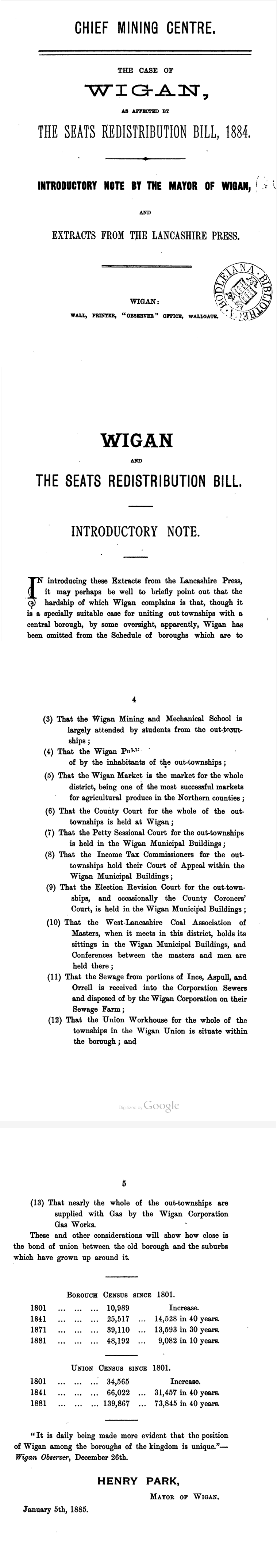
At the time, boroughs with populations between 15,000 and 50,000 were reduced from two MPs to one. Wigan’s campaigners argued that the 1881 census figures were misleading — around 2,000 local people were away seeking work during a mining strike. Had they been counted, the town’s population would have exceeded 50,000 and Wigan would have kept both MPs.
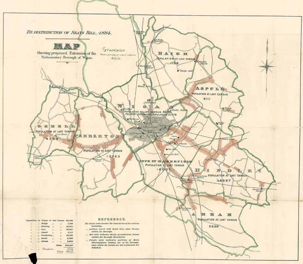
The pamphlet also stresses Wigan’s importance to the surrounding area and claims the official boundaries failed to reflect communities locally seen as part of the town. Some passages even suggest political motives, hinting that Wigan’s Conservative leanings suffered under a Liberal government.The map boldly sets out what campaigners believed were the “true” boundaries of the borough — showing a population well above the required threshold.
The protest material was produced by Thomas Wall, a Wigan printer and publisher of the Wigan Observer, demonstrating how fiercely the town defended its representation in Parliament.